This document was ed by and they confirmed that they have the permission to share it. If you are author or own the copyright of this book, please report to us by using this report form. Report 3b7i
Overview 3e4r5l
& View List Of Countries & Capital as PDF for free.
More details w3441
- Words: 4,839
- Pages: 27
List of Countries & Their Capital Alongwith Language & Currency Prepared by: Engr. Sajid Ali MS Electrical Engineering BS Electrical Engineering
Partially trying to prepare General Knowledge Segment of Various Tests being conducted in Pakistan Best of Luck to All Participants
Africa Africa
30,221,532 km2 (11,668,599 sq mi) Area Population 2,032,532,974[1] (2011, 2nd) Pop. density 30.51/km2 (about 80/sq mi) 57 (list of countries) Countries Languages Languages of Africa Time zones UTC-1 to UTC+4 Main articles: Africa and List of sovereign states and dependent territories in Africa Prepared By: Engr. Sajid Ali of NEPRA, Islamabad
Page 1
Further information: Geography of Africa For a table of sovereign states and dependent territories in Africa with geographical data such as area, population, and population density, see here. Africa is the world's second-largest and second-most-populous continent. At about 30.2 million km² (11.7 million sq mi) including adjacent islands, it covers six percent of the Earth's total surface area and 20.4 percent of the total land area.[2] With 1.0 billion people (as of 2009, see table), it s for about 15% of the world's human population. The continent is surrounded by the Mediterranean Sea to the north, both the Suez Canal and the Red Sea along the Sinai Peninsula to the northeast, the Indian Ocean to the southeast, and the Atlantic Ocean to the west. The continent includes Madagascar and various archipelagoes. It has 54 fully recognized sovereign states ("countries"), 10 territories and two de facto states with limited recognition.[3] Africa, particularly central Eastern Africa, is widely accepted as the origin of humans and the Hominidae clade (great apes), as evidenced by the discovery of the earliest hominids and their ancestors, as well as later ones that have been dated to around seven million years ago – including Sahelanthropus tchadensis, Australopithecus africanus, A. afarensis, Homo erectus, H. habilis and H. ergaster – with the earliest Homo sapiens (modern human) found in Ethiopia being dated to circa 200,000 years ago.[4] Africa straddles the equator and encomes numerous climate areas; it is the only continent to stretch from the northern temperate to southern temperate zones.[5] The African expected economic growth rate is at about 5.0% for 2010 and 5.5% in 2011 Flag
Name
Capital
Currency
Official language
Algeria
Algiers
Dinar
Arabic
Angola
Luanda
Kwanza
Portuguese
Benin
Porto-Novo (official) Cotonou (seat of government)
CFA franc
French
Botswana
Gaborone
Pula
English Setswana
Burkina Faso
Ouagadougou
CFA franc
French
Burundi
Bujumbura
Rupie
Cameroon
Yaoundé
CFA franc
Cape Verde
Praia
Cape Verdean escudo
Central African Republic
Bangui
CFA franc
Chad
N'Djamena
CFA franc
Prepared By: Engr. Sajid Ali of NEPRA, Islamabad
Kirundi French French English Portuguese French Sango French Arabic Page 2
Flag
Name
Capital
Currency
Comoros
Moroni
Comorian franc
Brazzaville
CFA franc
French
Yamoussoukro (official) Abidjan (seat of government)
CFA franc
French
Kinshasa
Congolese franc
French
Congo (CongoBrazzaville) Côte d'Ivoire (Ivory Coast) Democratic Republic of the Congo (CongoKinshasa) Djibouti
Djibouti
Egypt
Cairo
Equatorial Guinea
Djiboutian franc Egyptian pound
Equatorial Malabo Guinean peseta
Official language Comorian Arabic French
French Arabic Arabic Spanish French Portuguese Tigrinya Arabic English
Eritrea
Asmara
Tallero
Ethiopia
Addis Ababa
Birr
Amharic
Gabon
Libreville
CFA franc
French
Banjul Gambian dalasi
English
Accra
Ghana cedi
English
Conakry Guinean franc
French
Gambia Ghana Guinea Guinea-Bissau
Bissau
CFA franc
Portuguese
Kenya
Nairobi
Kenyan shilling
Lesotho
Maseru
Lesotho loti
Swahili English English Sesotho
Liberia
Monrovia Liberian dollar
English
Libya
Tripoli
Dinar
Arabic
Madagascar
Antananarivo
Malagasy ariary
Malagasy French
Prepared By: Engr. Sajid Ali of NEPRA, Islamabad
Page 3
Flag
Name
Capital
Currency
Official language English Chichewa
Malawi
Lilongwe
Kwacha
Mali
Bamako
CFA franc
French
Mauritania
Nouakchott
Ouguiya
Arabic
Mauritius
Port Louis
Mauritian rupee
Mauritian Creole French English
Mayotte
Mamoudzou Overseas department of
Euro
French
Morocco
Rabat
Arabic Berber
Mozambique
Maputo
Portuguese
Namibia
Windhoek
Moroccan dirham Mozambican metical Namibian dollar
Niger
Niamey
CFA franc
French
Nigeria
Abuja
Naira
English
Réunion
Saint-Denis Overseas department of
Euro
French
Rwanda
Kigali Rwandan franc
Kinyarwanda English French
Saint Helena, Ascension and Tristan da Cunha
Jamestown (Saint Helena) Saint Helena Georgetown (Ascension Island) pound Edinburgh of the Seven Seas (Tristan Pound sterling da Cunha)
English
English
Sao Tome and Principe
São Tomé
Dobra
Portuguese
Senegal
Dakar
CFA franc
French
Seychelles
Victoria
Seychellois rupee
Seychellois Creole French English
Sierra Leone
Freetown
Leone
English
Mogadishu Somali shilling
Somali Arabic
Somalia
Prepared By: Engr. Sajid Ali of NEPRA, Islamabad
Page 4
Flag
Name
Capital
Somaliland
Hargeisa
South Africa
Pretoria (istrative/executive) South African Cape Town (legislative) rand Bloemfontein (judicial)
South Sudan
Juba
Sudan
Khartoum
Swaziland Tanzania
Currency Somaliland shilling
South Sudanese pound Sudanese pound
Official language Somali Arabic Afrikaans English Southern Ndebele Northern Sotho Southern Sotho Swazi Tsonga Tswana Venda Xhosa Zulu English
Mbabane (istrative) Lobamba (royal and legislative) Dodoma (official) Dar es Salaam (seat of government)
Tanzanian shilling
Arabic English English Swati Swahili English
Lomé
CFA franc
French
Tunis Tunisian dinar
Arabic
Togo Tunisia
Kampala
Uganda
Lilangeni
Ugandan shilling
Swahili English Luganda
None
Western Sahara
Zambia
Moroccan None Disputed territory between dirham Morocco and the Sahrawi Algerian dinar Mauritanian Arab Democratic Republic ouguiya Zambian Lusaka kwacha
Zimbabwe
Harare
various
See respective claimants
English English Shona Sindebele
Asia Prepared By: Engr. Sajid Ali of NEPRA, Islamabad
Page 5
Asia
44,579,000 km2 (17,212,000 sq mi)[7] Area Population 5,879,000,000 (1st)[8] Pop. density 87/km2 (225/sq mi) 48 (list of countries) Countries Languages List of languages Time zones UTC+2 to UTC+12 Main articles: Asia and List of sovereign states and dependent territories in Asia See also: Eurasia and List of sovereign states and dependent territories in Eurasia Further information: Geography of Asia For a table of sovereign states and dependent territories in Asia with geographical data such as area, population, and population density, see here. Asia ( i/ˈeɪʒə/ or /ˈeɪʃə/) is the world's largest and most populous continent, located primarily in the eastern and northern hemispheres. It covers 8.7% of the Earth's total surface area (or 30% of its land area) and with approximately 4.3 billion people, it hosts 60% of the world's current human population. During the 20th century Asia's population nearly quadrupled.[9] Asia is defined as comprising the eastwards four-fifths of Eurasia. It is located to the east of the Suez Canal, the Ural river, and the Ural Mountains, and south of the Caucasus Mountains (or the Kuma-Manych Depression) and the Caspian and Black Seas.[10][11] It is bounded on the east by the Pacific Ocean, on the south by the Indian Ocean and on the north by the Arctic Ocean. Given its size and diversity, Asia – a toponym dating back to classical antiquity – "is more a cultural concept" incorporating diverse regions and peoples than a homogeneous physical entity.[12] Asia differs very widely among and within its regions with regard to ethnic groups, cultures, environments, economics, historical ties and government systems. Flag
Name
Capital
Prepared By: Engr. Sajid Ali of NEPRA, Islamabad
Currency
Official language Page 6
Flag
Name
Abkhazia
Capital
Currency
Sukhumi De facto sovereign state lacking general international recognition Russian ruble Recognized by United Nations as part of Georgia.
Official language Georgian Abkhaz Russian Pashto Dari (Persian) English Greek
Afghanistan
Kabul
Afghani
Akrotiri and Dhekelia
Episkopi Cantonment
Euro
Armenia
Yerevan
Dram
Armenian
Azerbaijan [Europe]
Baku
Manat
Azerbaijani
Bahrain
Manama
Bahraini dinar
Arabic
Bangladesh
Dhaka
Taka
Bengali
Bhutan
Thimphu
Bhutanese ngultrum Dzongkha
British Indian Ocean Territory
Diego Garcia US dollar Overseas territory of the United UK pound Kingdom
English
Brunei
Bandar Seri Begawan
Brunei dollar
Bahasa Melayu
Cambodia
Phnom Penh
Riel
Khmer
China
Beijing
Renminbi (yuan)
Standard Chinese
Australian dollar
English
Cocos (Keeling) Islands
Flying Fish Cove External territory of Australia West Island External territory of Australia
Cyprus [Europe]
Nicosia
Christmas Island
English Euro
East Timor (TimorDili Leste)
US Dollar
Georgia [Europe]
Tbilisi
Lari
Hong Kong
Special istrative region of Hong Kong dollar China
India
New Delhi
Prepared By: Engr. Sajid Ali of NEPRA, Islamabad
Rupee
Greek Turkish Portuguese Tetum Georgian English Cantonese Hindi English Page 7
Flag
Name
Capital
Currency
Official language
Indonesia
Jakarta
Rupiah
Indonesian
Iran
Tehran
Rial
Persian
Iraq
Baghdad
Iraqi dinar
Israel
Jerusalem
New shekel
Japan
Tokyo
Yen
Japanese
Jordan
Amman
Jordanian dinar
Arabic
Kazakhstan
Astana
Tenge
Kazakh Russian
Kurdistan
Erbil
Dinar
Kurdish
Kuwait
Kuwait City
Kuwaiti dinar
Arabic
Kyrgyzstan
Bishkek
Som
Kyrgyz Russian
Laos
Vientiane
Kip
Lao
Lebanon
Beirut
Lebanese pound
Arabic
Kurdish Arabic Hebrew Arabic
Special istrative region of Macanese pataca China Kuala Lumpur (official) Ringgit Putrajaya (seat of government)
Portuguese Cantonese
Maldives
Malé
Maldivian rufiyaa
Maldivian
Mongolia
Ulaanbaatar
Tögrög
Mongolian
Kyat
Burmese
Macau Malaysia
Myanmar (Burma) Naypyidaw
Stepanakert De facto sovereign state lacking Nagorno-Karabakh general international recognition Armenian dram Recognized by United Nations as de jure part of Azerbaijan Nepal
Kathmandu
Northern Cyprus
Nicosia Turkish lira De facto sovereign state lacking
Prepared By: Engr. Sajid Ali of NEPRA, Islamabad
Nepalese rupee
Malaysian
Armenian
Nepali Turkish Page 8
Flag
Name
Capital
Currency
Official language
general international recognition Recognized by United Nation as de jure part of Cyprus North Korea
Pyongyang
North Korean won
Korean
Oman
Muscat
Rial
Arabic
Pakistan
Islamabad
Pakistani Rupee
English Urdu
Palestine
East Jerusalem (claimed capital) Ramallah (West Bank seat of government) Gaza (Gaza Strip seat of government) Israeli shekel Territory occupied by Israel State of Palestine (flag displayed) proclaimed on territory
Philippines
Manila
Philippine Peso
Qatar
Doha
Riyal
Filipino English Arabic
Saudi Arabia
Riyadh
Saudi riyal
Arabic
Arabic
Singapore
Singapore
Singapore dollar
English Chinese Malay Tamil
South Korea
Seoul
South Korean won
Korean
South Ossetia
Tskhinvali De facto sovereign state lacking general international recognition Russian ruble Recognized by United Nations as de jure part of Georgia
Ossetic Georgian Russian
Sri Lanka
Colombo
Sri Lankan rupee
Sinhala Tamil
Syria
Damascus
Syrian pound
Arabic
Taiwan
Taipei De facto sovereign state lacking Standard general international recognition New Taiwan dollar Chinese Recognized by United Nations as part of China.
Prepared By: Engr. Sajid Ali of NEPRA, Islamabad
Page 9
Flag
Name
Capital
Currency
Official language
Tajikistan
Dushanbe
Somoni
Tajik
Thailand
Bangkok
Baht
Thai
Turkey [Europe]
Ankara
Turkish lira
Turkish
Turkmenistan
Ashgabat
Turkmen new manat Turkmen
United Arab Emirates
Abu Dhabi
UAE dirham
Arabic
Uzbekistan
Tashkent
Uzbekistan som (O'zbekiston so'mi)
Uzbek
Vietnam
Hanoi
đồng
Vietnamese
Yemen
Sana'a
Yemeni rial
Arabic
Tagalog
Europe Europe
10,180,000 km2 (3,930,000 sq mi)[n] Area Population 739,165,030[n] (2011), 3rd) Pop. density 72.5/km2 50 (list of countries) Countries Languages List of languages Time zones UTC to UTC+6 Main articles: Europe and List of sovereign states and dependent territories in Europe Prepared By: Engr. Sajid Ali of NEPRA, Islamabad
Page 10
See also: Eurasia and List of sovereign states and dependent territories in Eurasia Further information: Geography of Europe For a table of sovereign states and dependent territories in Europe with geographical data such as area, population, and population density, see here. Europe ( i/ˈjʊərəp/ EWR-əp or /ˈjɜrəp/ YUR-əp[13]) is, by convention, one of the world's seven continents. Comprising the westernmost peninsula of Eurasia, Europe is generally divided from Asia by the watershed divides of the Ural and Caucasus Mountains, the Ural River, the Caspian and Black Seas, and the waterways connecting the Black and Aegean Seas.[14] Europe is bordered by the Arctic Ocean to the north, the Atlantic Ocean to the west, the Mediterranean Sea to the south, and the Black Sea and connected waterways to the southeast. Yet the borders of Europe—a concept dating back to classical antiquity—are somewhat arbitrary, as the primarily physiographic term "continent" can incorporate cultural and political elements. Europe is the world's second-smallest continent by surface area, covering about 10,180,000 square kilometres (3,930,000 sq mi) or 2% of the Earth's surface and about 6.8% of its land area. Of Europe's approximately 50 states, Russia is by far the largest by both area and population, taking up 40% of the continent (although the country has territory in both Europe and Asia), while the Vatican City is the smallest. Europe is the third-most populous continent after Asia and Africa, with a population of 733 million or about 11% of the world's population.[15] Europe, in particular Ancient Greece, is the birthplace of Western culture.[16] It played a predominant role in global affairs from the 15th century onwards, especially after the beginning of colonialism. Between the 16th and 20th centuries, European nations controlled at various times the Americas, most of Africa, Oceania, and large portions of Asia. In 1900, Europe's share of the world's population was 25%.[17] Both World Wars were largely focused upon Europe, greatly contributing to a decline in Western European dominance in world affairs by the mid-20th century as the United States and Soviet Union took prominence.[18] During the Cold War, Europe was divided along the Iron Curtain between NATO in the west and the Warsaw Pact in the east. European integration led to the formation of the Council of Europe and the European Union in Western Europe, both of which have been expanding eastward since the revolutions of 1989 and the fall of the Soviet Union in 1991. Flag
Name
Capital
Currency
Official language
Åland Islands
Mariehamn Autonomous region of Finland (recognized Euro by international treaty)
Swedish
Albania
Tirana
Lek
Albanian
Andorra
Andorra la Vella
Euro
Catalan
Austria
Vienna
Euro
German
Belarus
Minsk
Belarusian ruble
Belarusian Russian
Prepared By: Engr. Sajid Ali of NEPRA, Islamabad
Page 11
Flag
Name
Capital
Currency
Official language Dutch French German Bosnian Croatian Serbian
Belgium
Brussels
Euro
Bosnia and Herzegovina
Sarajevo
Convertible mark
Bulgaria
Sofia
Lev
Bulgarian
Croatia
Zagreb
Kuna
Croatian
Czech Republic
Prague
Czech koruna
Czech
Denmark
Copenhagen
Danish krone[a] Danish
Estonia
Tallinn
Euro
Estonian
Faroe Islands
Tórshavn Self-governing territory of the Danish Realm
Faroese króna
Faroese Danish
Finland
Helsinki
Euro
Finnish Swedish
Paris
Euro CFP franc
French
Berlin
Euro
German
Gibraltar
Gibraltar Overseas territory of the United Kingdom
Gibraltar pound
English
Greece
Athens
Euro
Greek
Guernsey
Saint Peter Port British Crown dependency
Pound sterling
English French
Hungary
Budapest
Forint
Hungarian
Iceland
Reykjavík
Icelandic króna Icelandic
Ireland
Dublin
Euro
Isle of Man
Douglas British Crown dependency
Irish English Pound sterling Manx
Italy
Rome
Euro
English
Prepared By: Engr. Sajid Ali of NEPRA, Islamabad
Italian
Page 12
Flag
Name Jersey
Kosovo
Capital
Official language English Pound sterling French Currency
Saint Helier British Crown dependency Pristina De facto sovereign state recognized by over 80 UN member states Euro A United Nations mandate in Serbian territory was put in place starting in 1999.
Albanian Serbian
Latvia
Ryga
Euro
Latvian
Liechtenstein
Vaduz
Swiss franc
German
Lithuania
Vilnius
Lithuanian litas Lithuanian
Luxembourg
Luxembourg
Euro
Luxembourgish French German
Macedonia
Skopje
Macedonian denar
Macedonian
Malta
Valletta
Euro
Maltese English
Moldova
Chişinău
Moldovan leu
Moldovan
Monaco
Monaco
Euro
French
Montenegro
Podgorica
Euro
Montenegrin
Amsterdam
Euro US dollar NA guilder Aruban florin
Dutch
Norway
Oslo
Norwegian krone
Norwegian Bokmål Nynorsk
Poland
Warsaw
Złoty
Polish
Portugal
Lisbon
Euro
Portuguese
Romania
Bucharest
Romanian leu
Romanian
Russia
Moscow
Russian ruble
Russian 27 others coofficial
San Marino
San Marino
Euro
Italian
Netherlands
Prepared By: Engr. Sajid Ali of NEPRA, Islamabad
Page 13
Flag
Name
Capital
Currency
Official language
Serbia
Belgrade
Serbian dinar
Serbian
Slovakia
Bratislava
Euro
Slovak
Slovenia
Ljubljana
Euro
Slovene
Euro
Spanish Catalan Galician Basque
Spain
Madrid
Svalbard
Longyearbyen Norwegian Special territory of Norway (recognized by krone international treaty)
Sweden
Stockholm
Norwegian
Swedish krona Swedish
Switzerland
Bern
Swiss franc
German French Italian Romansh
Transnistria
Tiraspol De facto sovereign state lacking general international recognition Recognized by United Nations as de jure part of Moldova
Transnistrian ruble
Russian Moldovan Ukrainian
Ukraine
Kiev
Ukrainian hryvnia
Ukrainian
United Kingdom
London
Pound sterling English
Vatican City
Vatican City
Euro
Italian
North America North America
Prepared By: Engr. Sajid Ali of NEPRA, Islamabad
Page 14
Area
24,709,000 km2 (9,540,000 sq mi)
Population
528,720,588 (2008, 4th)
Pop. density
22.9/km2 (59.3/sq mi)[b]
Countries
23 (list of countries)
Languages
List of languages
Time zones
UTC-10 to UTC
Main articles: North America and List of sovereign states and dependent territories in North America See also: Americas and List of sovereign states and dependent territories in the Americas Further information: Geography of North America
For a table of sovereign states and dependent territories in North America with geographical data such as area, population, and population density, see here. North America is a continent wholly within the Northern Hemisphere and almost wholly within the Western Hemisphere. It is also considered a northern subcontinent of the Americas.[19] It is bordered to the north by the Arctic Ocean, to the east by the Atlantic Ocean, to the west and south by the Pacific Ocean, and to the southeast by South America and the Caribbean Sea. North America covers an area of about 24,709,000 square kilometers (9,540,000 square miles), about 4.8% of the planet's surface or about 16.5% of its land area. As of July 2008, its population was estimated at nearly 529 million people across 23 independent states. North America is the third-largest continent in area, following Asia and Africa, and the fourth in population after Asia, Africa, and Europe.
Prepared By: Engr. Sajid Ali of NEPRA, Islamabad
Page 15
Flag
Name
Capital
Currency
Official language
Anguilla
The Valley Overseas territory of the United Kingdom
East Caribbean Dollar
English
Antigua and Barbuda
St. John's
East Caribbean Dollar
English
Aruba
Oranjestad Constituent country of the Kingdom of the Netherlands
Aruban florin
Papiamento Dutch
Bahamas
Nassau
Bahamian Dollar
English
Barbados
Bridgetown
Barbadian Dollar
English
Belize
Belmopan
Belize Dollar
English
Bermuda
Hamilton Overseas territory of the United Kingdom
Bermudian Dollar
English
Bonaire
Kralendijk United States Dollar Special municipality of the Netherlands
Dutch
British Virgin Islands
Road Town Overseas territory of the United Kingdom
United States Dollar
English
Canada
Ottawa
Canadian Dollar
French English
Cayman Islands
George Town Overseas territory of the United Kingdom
Cayman Islands Dollar English
Clipperton Island
uninhabited Overseas territory of
Euro
Prepared By: Engr. Sajid Ali of NEPRA, Islamabad
French
Page 16
Flag
Name
Capital
Currency
Official language
Costa Rica
San José
Costa Rican colon
Spanish
Cuba
Havana
Cuban peso
Spanish
Curaçao
Willemstad Constituent country of the Kingdom of the Netherlands
Netherlands Antillean Papiamento guilder Dutch
Dominica
Roseau
East Caribbean Dollar
English
Dominican Republic
Santo Domingo
Dominican peso
Spanish
El Salvador
San Salvador
United States Dollar
Spanish
Greenland
Nuuk Self-governing territory of the Danish Realm
Danish Krone
Greenlandic
Grenada
St. George's
East Caribbean Dollar
English
Guadeloupe
Basse-Terre Overseas department of
Euro
French
Guatemala
Guatemala City
Guatemalan quetzal
Spanish
Haiti
Port-au-Prince
Haitian gourde
French
Honduras
Tegucigalpa
Honduran lempira
Spanish
Jamaica
Kingston
Jamaican Dollar
English
Martinique
Fort-de- Overseas department of
Euro
French
Mexico
Mexico City
Mexican peso
Spanish
Prepared By: Engr. Sajid Ali of NEPRA, Islamabad
Page 17
Flag
Name
Capital
Currency
Official language
Montserrat
Plymouth (official) Brades (seat of government) Overseas territory of the United Kingdom
East Caribbean Dollar
English
Navassa Island
Insular area of the United States of America
United States Dollar
English
Nicaragua
Managua
Nicaraguan cordoba
Spanish
Panama
Panama City
United States Dollar Panamanian balboa
Spanish
Puerto Rico
San Juan Insular area of the United States of America
United States Dollar
English Spanish
Saba
The Bottom United States Dollar Special municipality of the Netherlands
Saint Barthélemy
Gustavia Overseas collectivity of
Euro
French
Saint Kitts and Nevis
Basseterre
East Caribbean Dollar
English
Saint Lucia
Castries
East Caribbean Dollar
English
Saint Martin
Marigot Overseas collectivity of
Euro
French
Saint Pierre and Miquelon
Saint-Pierre Overseas collectivity of
Euro
French
Saint Vincent and the Grenadines
Kingstown
East Caribbean Dollar
English
Sint Eustatius
Oranjestad United States Dollar Special municipality of the Netherlands
Prepared By: Engr. Sajid Ali of NEPRA, Islamabad
Page 18
Flag
Name
Capital
Currency
Official language
Sint Maarten
Philipsburg Constituent country of the Kingdom of the Netherlands
Netherlands Antillean guilder
Trinidad and Tobago
Port of Spain
Trinidad and Tobago Dollar
English
Turks and Caicos Islands
Cockburn Town Overseas territory of the United Kingdom
United States Dollar
English
United States
Washington, D.C.
United States Dollar
none
United States Virgin Islands
Charlotte Amalie Insular area of the United States of America
United States Dollar
English
South America South America
17,840,000 km2 Area (6,890,000 sq mi)
Prepared By: Engr. Sajid Ali of NEPRA, Islamabad
Page 19
Population
387,489,196 (2011, 5th)
Pop. density
21.4 per km2 (56.0 per sq mi)
Countries
12 (list of countries)
Languages
List of languages
Time zones
UTC-2 to UTC-5
Main articles: South America and List of sovereign states and dependent territories in South America See also: Americas and List of sovereign states and dependent territories in the Americas Further information: Geography of South America
For a table of sovereign states and dependent territories in South America with geographical data such as area, population, and population density, see here. South America is a continent located in the Western Hemisphere, mostly in the Southern Hemisphere, with a relatively small portion in the Northern Hemisphere.[20][21] It is bordered on the west by the Pacific Ocean and on the north and east by the Atlantic Ocean; North America and the Caribbean Sea lie to the northwest. It is formed by twelve sovereign states - Argentina, Bolivia, Brazil, Chile, Colombia, Ecuador, Guyana, Paraguay, Peru, Suriname, Uruguay, and Venezuela the French Guiana, which is an overseas region of , and the Falkland Islands, a British Overseas Territory. In addition to this, the ABC islands of the Netherlands may also be considered part of South America, as well as Trinidad and Tobago. The South American states that border the Caribbean Sea – Colombia, Venezuela, Guyana, Suriname, and French Guiana – are also known as Caribbean South America. South America has an area of 17,840,000 square kilometers (6,890,000 sq mi). Its population as of 2005 has been estimated at more than 371,090,000. South America ranks fourth in area (after Asia, Africa, and North America) and fifth in population (after Asia, Africa, Europe, and North America). The word America was coined in 1507 by cartographers Martin Waldseemüller and Matthias Ringmann, after Amerigo Vespucci, who was the first European to suggest that the lands newly discovered by Europeans were not India, but a New World unknown to Europeans. Flag
Name
Capital
Currency
Official language
Argentina
Buenos Aires
Peso
Spanish
Bolivia
Sucre (official) La Paz (seat of government)
Boliviano
Spanish Quechua
Prepared By: Engr. Sajid Ali of NEPRA, Islamabad
Page 20
Flag
Name
Capital
Currency
Official language Aymara
Brazil
Brasília
Real
Portuguese
Chile
Santiago
Peso
Spanish
Colombia
Bogotá
Peso
Spanish
Ecuador
Quito
United States dollar
Spanish
Falkland Islands
Stanley Falkland Islands pound English Overseas territory of the United Kingdom
French Guiana
Cayenne Overseas department of
Euro
French
Guyana
Georgetown
Guyanese dollar
English
Paraguay
Asunción
Guaraní
Spanish Guaraní
Peru
Lima
Nuevo sol
Spanish
Suriname
Paramaribo
Surinamese dollar
Dutch
Uruguay
Montevideo
Uruguayan peso
Spanish
Venezuela
Caracas
Bolívar fuerte
Spanish
Oceania Oceania
Prepared By: Engr. Sajid Ali of NEPRA, Islamabad
Page 21
Geopolitical Oceania
8,560,000 km2 Area (3,310,000 sq mi) Population
38,304,000 (2013, 5th)
Pop. density
4.47 per km2 (11.57 per sq mi)
Countries
14 (list of countries)
Languages
List of languages
Time zones
UTC-2 to UTC-5
Main articles: Oceania and List of sovereign states and dependent territories in Oceania See also: Australia (continent) and Pacific Islands Further information: Geography of Oceania
For a table of sovereign states and dependent territories in Oceania with geographical data such as area, population, and population density, see here. Australia (UK /ˌoʊʃɪˈɑːnɪə/ or /ˌoʊsɪˈɑːnɪə/;[22] US /ˌoʊʃiːˈæniːə/)[23] is a region centered on the islands of the tropical Pacific Ocean.[24] Opinions of what constitutes Oceania range from the coral atolls and volcanic islands of the South Pacific (ethnologically divided into the subregions of Melanesia, Micronesia, and Polynesia)[25] to the entire insular region between Asia and the Americas, including Australasia and the Maritime Southeast Asia.The term is sometimes used more specifically to denote a continent comprising Australia and proximate islands,[26][27][28][29] or biogeographically as a synonym for either the Australasian ecozone (Wallacea and Australasia) or the Pacific ecozone (Melanesia, Polynesia, and Micronesia apart either from New Zealand[30] or from mainland New Guinea).[31] Prepared By: Engr. Sajid Ali of NEPRA, Islamabad
Page 22
Flag
Name
Capital
Currency
Pago Pago American Samoa Insular area of the United States of America
United States dollar
Ashmore and Cartier Islands — External territory of Australia
—
Australia
Canberra
Australian dollar
Baker Island
—
Insular area of the United States of America
Cook Islands
Avarua Self-governing parliamentary democracy in free association with New Zealand
New Zealand dollar Cook Islands dollar
Coral Sea Islands —
External territory of Australia
Fiji
Suva
Fijian dollar
French Polynesia
Papeete Overseas collectivity of
CFP Franc
Guam
Hagåtña
Insular area of the United States of America
Howland Island
—
Insular area of the United States of America
Jarvis Island
—
Insular area of the United States of America
Johnston Atoll
—
Insular area of the United States of America
Kingman Reef
—
Insular area of the United States of
Prepared By: Engr. Sajid Ali of NEPRA, Islamabad
Official language English Samoan
None[c]
English Cook Islands Māori
French
Page 23
Flag
Name
Capital
Currency
Official language
America Kiribati
South Tarawa
Marshall Islands Majuro Micronesia
Palikir
Midway Atoll
—
Nauru
Yaren (seat of government)
New Caledonia
Nouméa Sui generis collectivity (special collectivity) of
Insular area of the United States of America
CFP Franc
French
Maori New Zealand Sign English
New Zealand
Wellington
New Zealand Dollar
Niue
Alofi
Self-governing parliamentary democracy in free association with New Zealand
Norfolk Island
Kingston
Self-governing territory of Australia
Northern Saipan Mariana Islands Palau
Ngerulmud
Palmyra Atoll
—
Papua New Guinea
Port Moresby
Prepared By: Engr. Sajid Ali of NEPRA, Islamabad
Insular area of the United States of America
Insular area of the United States of America
Page 24
Flag
Name
Capital
Pitcairn Islands
Adamstown
Samoa
Apia
Currency
Official language
Overseas territory of the United Kingdom
Solomon Islands Honiara
Tokelau
Nukunonu (main settlement, although each atoll has its own istrative Dependent territory of New Zealand centre)
Tonga
Nukuʻalofa
Tuvalu
Funafuti
Vanuatu
Port Vila
Vanuatu vatu
Wake Island
— Insular area of the United States of America
United States dollar
Wallis and Futuna
Mata-Utu Overseas collectivity of
CFP Franc
Bislama French English
French
Antarctica Antarctica
Prepared By: Engr. Sajid Ali of NEPRA, Islamabad
Page 25
Area
14,000,000 km2 (5,400,000 sq mi)[32]
Main article: Antarctica Further information: Geography of Antarctica
Antarctica ( i/æntˈɑrtɨkə/ or /ænˈtɑrktɨkə/)[d] is Earth's southernmost continent, containing the geographic South Pole. It is situated in the Antarctic region of the Southern Hemisphere, almost entirely south of the Antarctic Circle, and is surrounded by the Southern Ocean. At 14.0 million km2 (5.4 million sq mi), it is the fifth-largest continent in area after Asia, Africa, North America, and South America. For comparison, Antarctica is nearly twice the size of Australia. About 98% of Antarctica is covered by ice that averages at least 1 mile (1.6 km) in thickness. Antarctica, on average, is the coldest, driest, and windiest continent, and has the highest average elevation of all the continents.[35] Antarctica is considered a desert, with annual precipitation of only 200 mm (8 inches) along the coast and far less inland.[36] The temperature in Antarctica has reached −89 °C (−129 °F). There are no permanent human residents, but anywhere from 1,000 to 5,000 people reside throughout the year at the research stations scattered across the continent. Only cold-adapted organisms survive there, including many types of algae, animals (for example mites, nematodes, penguins, seals and tardigrades), bacteria, fungi, plants, and protista. Vegetation where it occurs is tundra. Although myths and speculation about a Terra Australis ("Southern Land") date back to antiquity, the first confirmed sighting of the continent is commonly accepted to have occurred in 1820 by the Russian expedition of Fabian Gottlieb von Bellingshausen and Mikhail Lazarev on Vostok and Mirny. The continent, however, remained largely neglected for the rest of the 19th century because of its hostile environment, lack of resources, and isolation. The Antarctic Treaty was signed in 1959 by 12 countries; to date, 49 countries have signed the treaty. The treaty prohibits military activities and mineral mining, prohibits nuclear explosions and nuclear waste disposal, s scientific research, and protects the continent's ecozone. Ongoing experiments are conducted by more than 4,000 scientists from many nations.
Prepared By: Engr. Sajid Ali of NEPRA, Islamabad
Page 26
Antarctica is regulated by the Antarctic Treaty System, which defines it as all land and ice shelves south of 60°S, and has no government and belongs to no country. However, the following territorial claims in Antarctica have been made:
Argentina: Argentine Antarctica Australia: Australian Antarctic Territory Brazil: Brazilian Antarctica (unofficial) Chile: Antártica : Adélie Land New Zealand: Ross Dependency Norway: Peter I Island and Queen Maud Land United Kingdom: British Antarctic Territory (Unclaimed: Marie Byrd Land)
Moreover, the following dependent territories are situated in the wider Antarctic Region: Flag
Name
Capital
Official Language
Currency
Bouvet Island Dependent territory of Norway
—
—
—
French Southern Territories
Alfred Faure (Crozet Islands) Port-aux-Français (Kerguelen Islands) Martin-de-Viviès (Saint Paul and Amsterdam Islands) Overseas territory of
Euro
French
—
—
Pound sterling
English
Heard Island and McDonald Islands — External territory of Australia South Georgia and the South Sandwich Islands
King Edward Point Overseas territory of the United Kingdom
© Pls ignore the errors as this document has been prepared from different sources like Wikipedia, Google etc. specially the spelling mistakes.
Engr Sajid Ali Prepared By: Engr. Sajid Ali of NEPRA, Islamabad
Page 27
Related Documents 3m3m1z
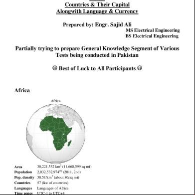
October 2019 79

List Of Schengen Countries 11491u
August 2021 0
List Of French Speaking Countries 1j5z6d
November 2019 62
List Of Tropical Countries - Tropical u1h36
November 2019 86
Countries With Capital And Currency Of Asia 3y2j2y
December 2019 80
All Countries Holiday List - 2018 3z70p
December 2019 56More Documents from "Sajid Ali" 3h3421

Notice Transitional Arrangement 635y4g
December 2019 42
3.7 Strategic Financial Management (old Syllabus) Of Acca Past Papers With Answers From2002-2006 485x73
July 2022 0
3.7 Strategic Financial Management (old Syllabus) Of Acca Past Papers With Answers From2002-2006 485x73
January 2022 0
Principles Of Managerial Finance 13th Edition Solution Manual y3p3w
November 2019 87
Principles Of Managerial Finance 13th Edition Solution Manual y3p3w
December 2021 0